Riding out of Melbourne
Melbourne sits at the centre of a tight set of riding options. The coast road west is the famous one, the forest spurs east are the local ones, and the alpine country in the north-east is the reason to take a week rather than a day.
Yarra Ranges National Park sits between Melbourne and the Victorian Alps, and the Black Spur Drive runs from Healesville through Mountain Ash forest to Narbethong. That closeness is what makes the region work: a serious ride in tall forest, starting within reach of the suburbs, without a long drone first.
The state is small enough that you can ride from the coast to the alpine country inside a day, and that changes how a trip is planned. Instead of picking one region for a week, you can link two or three: forest in the morning, a pass after lunch, a coast town by evening. The trade-off is that you spend more of the day riding between places and less of it riding the places themselves. Where the trip starts from decides which of these you get first, and rides out of Melbourne sets out the exits from the city.
Victorian weather turns over quickly. The Great Ocean Road region's road safety advice is to expect four seasons in one day and to ride to the conditions rather than to the sign.
Great Ocean Road and the Otways
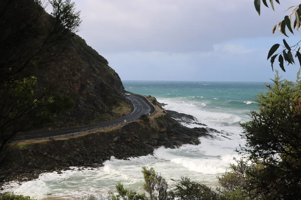
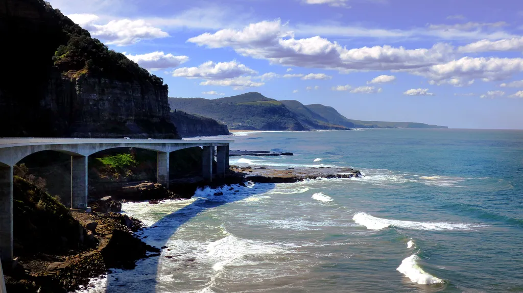
The Great Ocean Road runs west from the surf coast through Lorne and Apollo Bay towards the shipwreck coast, with the Otways behind it. Great Otway National Park covers over 1,000 square kilometres of tall forest, fern gullies, waterfalls, coastal heathland and rock platforms, and the roads through it are as much the point as the coastline.
Traffic is the reality of this road. It is a touring route first and a through route second, carrying caravans, campervans and holiday traffic alongside locals going about their day, and the region's own safety advice is that if you are holding up traffic you should pull over as soon as it is safe and let faster vehicles pass. Sections are narrow and winding, and the regional advice is blunt that journeys take longer than the map suggests. The Otway weather is the other variable, and choosing the month explains why the southern coast suits the shoulder seasons.
- Keep left, every time; the whole road assumes it.
- Allow extra time, because some sections are narrow and winding and the journey takes longer than it looks.
- Take regular rest breaks, get out and stretch; regional advice suggests a break about every two hours.
- Watch for animals on rural roads near sunset and sunrise.
- Keep your headlights on so you are seen more easily.
- Never cross a solid white line on your side of the centre line.
Accredited visitor information centres along the route are set up as rest stops in a regional push to reduce fatigue on long drives.
Black Spur and the Yarra Ranges
The Black Spur is the best-known road in the Yarra Ranges: a short, tightly wooded run from Healesville to Narbethong through Mountain Ash forest, the world's tallest flowering tree, with tree ferns and mossy myrtle beech in the gullies.
It is a short road with a big reputation, and it works best as part of a loop rather than as a destination on its own. Pair it with the lookouts and the towns on either side, and ride it for the forest rather than for speed.
- Healesville is the start of the Black Spur Drive.
- Mount Donna Buang, at 1,245 metres, has one of the best lookouts in the park.
- Walking trails and picnic areas sit off the spur, including Donnelly's Weir and Dom Dom Saddle.
- The higher parts of the ranges get snow in winter, so check conditions before riding up.
Clear streams in the ranges feed the Yarra River and the reservoirs Melbourne draws its drinking water from, so the forest is managed as a catchment as well as a park.
Reefton Spur and the upper Yarra
Reefton Spur is the other forest road through the ranges, running over the top between the upper Yarra country and the Cambarville and Marysville side. It is narrower, quieter and more remote than the Black Spur, and it suits a rider who is comfortable on a tight, tree-lined road with limited sight lines.
Ride it as a loop with the Warburton and Healesville valleys rather than as an out-and-back, and treat the surface as variable: this is forest road country, not a main road.
Midweek, the forest belongs to almost nobody: a few local vehicles, walkers at the trailheads, and long quiet stretches between them. When the coast is crawling with holiday traffic, that is the argument for turning inland instead.
- Expect narrow lanes, deep shade and leaf litter after rain.
- Fuel and food are in the valley towns on either side, not on the spur itself.
- Snow can settle on the higher sections in winter, which changes the road entirely.
Riding both spurs properly in one day is a long day; pick one and give it the time it deserves.
The Great Alpine Road
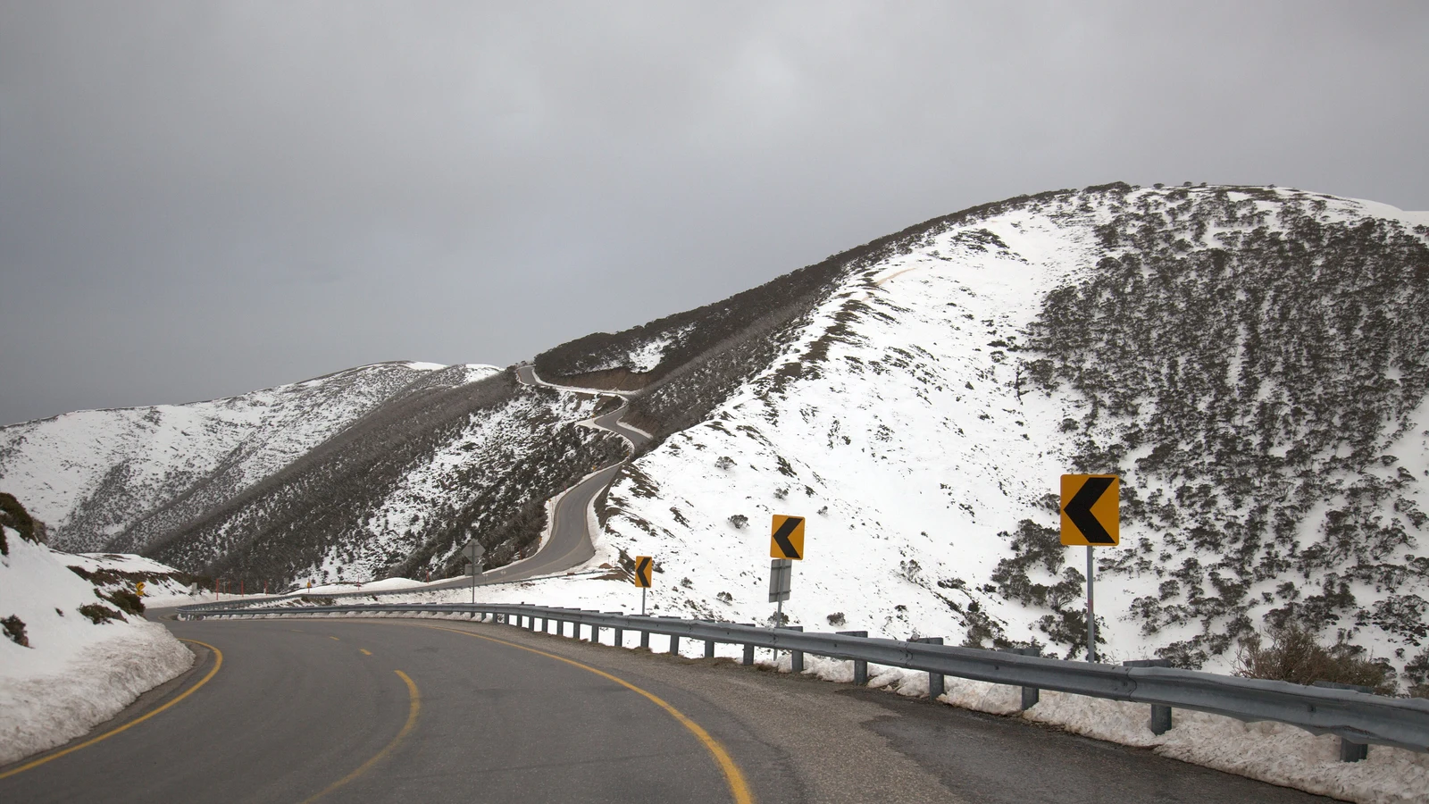
The Great Alpine Road is the long one. It runs from the Gippsland lakes country at Bairnsdale up through Omeo, Dinner Plain, Mount Hotham and Harrietville to Bright and on towards Wangaratta, crossing the Alpine National Park on the way. Victoria's highest peak, Mount Bogong, and its second highest, Mount Feathertop, are both in the park, and the Falls to Hotham country is the heart of it.
This is a road with real altitude on it. The Hotham section is the one to plan around, because snow and ice close or restrict alpine roads in winter, and the weather near the top has little to do with the weather at Bairnsdale. Ride it in the warmer months unless you are properly set up for alpine conditions.
It is also a road you can approach from either end, and that changes the day. Coming up from Bairnsdale puts the climb in the middle of the day; coming down from Bright or Wangaratta reverses it. Either way, the weather at the top is the part you cannot plan around, only check.
- Plan the day around the climb and the descent rather than the total distance.
- Fuel, food and accommodation are in the valley towns; the top is remote and exposed.
- Check road conditions before you commit to the Hotham section.
- Expect slow traffic on the climbs, and overtake only where you can see the road ahead.
The alpine road is a touring route as well as a ride, so patience on the climbs is part of the deal.
Grampians and the far west
The Grampians (Gariwerd) National Park rises out of flat plains north-west of Melbourne, and it is a different kind of riding to the forest spurs: long approach roads, then tight, twisting climbs into sandstone ranges with waterfalls and lookouts. The park is part of the Gariwerd Aboriginal cultural landscape, and it is heritage listed for its Aboriginal heritage, its plants and animals, and its scenery.
Wildlife is part of the ride here rather than a rare sighting. Kangaroos, wallabies, emus and native birds are all common in the park, which means the hours around dawn and dusk need care.
- Waterfalls and lookout roads are the main reason to loop through the ranges.
- The approach is open farmland; the riding starts to work where the road meets the ranges.
- Spring brings wildflower displays to the ranges, which is when the park is at its most colourful.
The Grampians are a long way from the coast in character as well as distance; allow for wind and a wide temperature range.
Gippsland and the Mornington Peninsula
Gippsland is the quiet side of the state for riders: the Gippsland Lakes, the forest behind them, and Wilsons Promontory at the southern end, where the coast road finishes at Tidal River. It is a region for slow loops and long views rather than tight passes.
Closer to Melbourne, the Mornington Peninsula's ocean side is a half-day ride out of the city, with back-beach roads and the bay crossing at Sorrento at the end of it if you want to make a loop of the bay rather than retracing your route. If you would rather see the coast and the alpine road on the same trip without unpacking every night, campervan hire in Melbourne puts the bed behind the same roads.
- Gippsland rewards the longer way round: the coast road and the forest roads behind it make a natural loop.
- The peninsula works as a short ride from the city, or as a link to the bay crossing.
- Both regions are coastal, so wind and afternoon sea breeze are part of the planning.
Questions riders ask
When is the best time to ride the Great Ocean Road?
There is no single window. The region's own road safety advice is to expect four seasons in one day and to ride to the conditions, taking a break about every two hours. Accredited visitor information centres along the route are set up as rest stops at any time of year.
Can I ride the Victorian alpine roads in winter?
Snow and ice close or restrict alpine roads, so the Great Alpine Road over Mount Hotham is best left to the warmer months unless you are properly prepared and have checked conditions. The high country is open year-round in other respects, but the roads are the constraint.
Is the Black Spur a day ride from Melbourne?
Yes. The Black Spur Drive starts at Healesville, inside the Yarra Ranges National Park between Melbourne and the Victorian Alps, and runs through Mountain Ash forest to Narbethong. It pairs well with Mount Donna Buang and the villages of Marysville and Warburton.
What do I need to ride legally in Victoria?
An approved helmet and a valid motorcycle licence or permit are required by law. Victorian road safety guidance also notes the blood alcohol concentration limit of 0.05 per cent, strict speed enforcement, and a ban on using a handheld mobile phone while driving.
Sources
- Visit Great Ocean Road — Road Safety — visitgreatoceanroad.org.au
- Parks Victoria — Great Otway National Park(parks.vic.gov.au)
- Parks Victoria — Yarra Ranges National Park(parks.vic.gov.au)
- Parks Victoria — Alpine National Park(parks.vic.gov.au)
- Parks Victoria — Grampians (Gariwerd) National Park(parks.vic.gov.au)