Ride it west, towards the sun
The Great Ocean Road runs 243 kilometres from Torquay to Allansford, near Warrnambool, and it was built as a memorial to the soldiers who did not come home from the First World War. Start at the eastern end and ride west.
The reason for that direction is practical rather than sentimental. VicRoads' own guidance for the road says most scenic lookout carparks sit on the ocean side, and that they are best accessed when travelling south-west, because that avoids crossing the path of oncoming vehicles hidden around blind corners. Its advice for the return journey, heading back towards Geelong, is to use an inland route instead.
VicRoads describes the round trip from Melbourne to Port Campbell and back as too long to do in one day, and suggests making it a two-day trip.
Torquay to Lorne
The first section is the busiest and the easiest. Torquay is the surfing town at the start of it, Bells Beach sits just beyond, and the road then runs through Anglesea and Aireys Inlet before the climb into Lorne.
- Torquay and Bells Beach: the surf coast proper, and the first place the ride starts to feel like the coast road.
- Anglesea and Aireys Inlet: the last of the surf-coast towns before the Otway coast begins in earnest.
- Lorne: the first real stop, and a good place to break before the road starts to twist.
Lorne to Apollo Bay
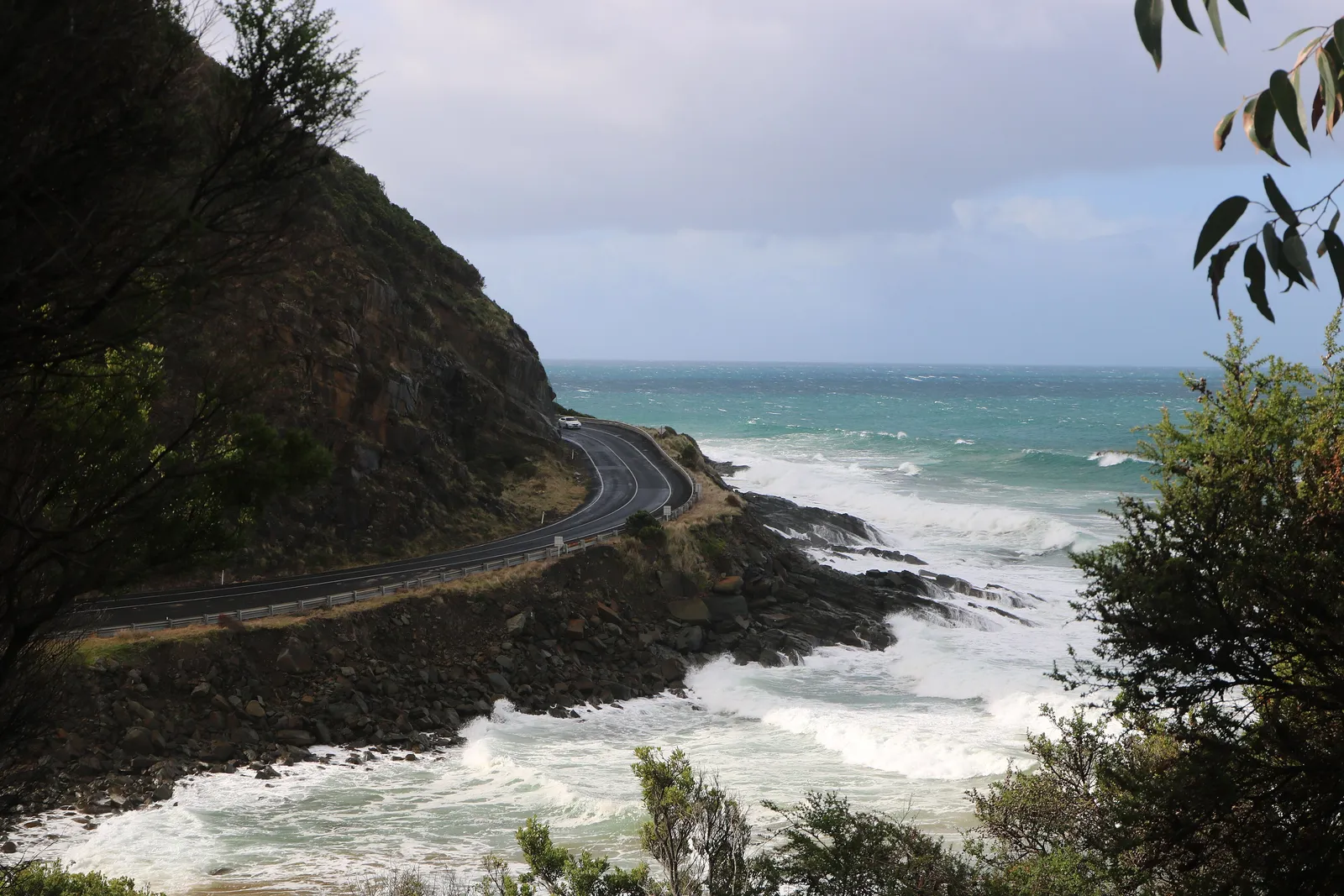
This is the section people picture when they picture the Great Ocean Road: the road cut into the hillside with the ocean immediately below it, blind corners, and almost no room for overtaking lanes. VicRoads notes that turnout lanes exist specifically so slower vehicles can let the queue behind them past, which tells you everything about the pace of a busy day.
It is short in distance and long in time. Take it slowly, use the turnouts if you are the slower vehicle, and expect the corner before the view to be tighter than it looks.
Through the Otway forests
Past Apollo Bay the character changes completely. Great Otway National Park stretches from Torquay to Princetown and back up through the hinterland towards Colac, and the riding becomes tall forest, fern gullies and shaded road rather than ocean.
The Otways are rainforest country, and water is the theme. Parks Victoria notes that seasonal track closures apply to many tracks to protect them from water damage, which is a useful reminder that this is wet country where the forest holds moisture long after the weather clears.
Access into the Otways is either from Geelong along the Great Ocean Road, or inland from Colac on the C155 and C164, and the western approach comes in past Port Campbell on the same coastal road.
The waterfalls most riders detour for are Triplet, Hopetoun, Erskine and Kalimna falls, all reached on foot from short walks rather than from the road.
Port Campbell and the shipwreck coast
The coast west of Cape Otway is limestone stacks, cliffs and a hard, cold sea, and the road stops being a coastal run and becomes a series of viewpoints with short rides between them.
- The Twelve Apostles and Loch Ard Gorge are the two that everyone stops at, and the car parks fill accordingly.
- Port Campbell is the natural overnight stop for the western half of the road.
- Princetown and the stretches either side of it are where the wind gets under a bike in a way the sheltered Lorne section never does.
Warrnambool and Port Fairy
The signposted Great Ocean Road finishes at Allansford, just outside Warrnambool, which is also where the inland roads take over. Riding on to Port Fairy is a short detour rather than part of the official road, and it changes the feel of the trip: a bluestone town with architecture from the 1800s and a maritime history, instead of another lookout.
If you only have two days, Warrnambool or Port Fairy is where you sleep and turn around. If you have three, the next section is the reason to keep going.
Timing it around the crowds
Timing decides whether this road is a ride or a queue. The regional tourism body puts peak season at the summer holidays from late December to January, plus the Easter long weekend, and recommends planning around those periods or travelling in autumn or winter instead, when the same coast has far fewer people on it. The season logic behind that is set out in when to ride, region by region, which treats the southern coast as a shoulder-season route.
Winter is not the compromise it sounds like. The regional tourism body points to the cooler months for flowing waterfalls and whale watching, with Warrnambool listed as a whale-watching spot from May to September and the western end of the road good for sightings from May to October. What winter does bring is the Otway wet: shaded forest road that stays damp long after the weather clears, and leaf litter on the corners.
- Late December to January and the Easter long weekend: the busiest stretch, and the one to avoid if you want the bends to yourself.
- Autumn and winter: fewer vehicles, wetter forest roads, and the waterfalls and whale season as the compensation.
- Weekdays over weekends at any time of year, for the Lorne to Apollo Bay section in particular.
- Dawn and dusk, when the regional tourism body says much of the Otways wildlife is most active, and when the light on the limestone is at its best.
The road carries local traffic as well as tourists, so a clear forecast does not mean a clear road. Check VicRoads' traffic conditions before the Lorne to Apollo Bay stretch.
The shape of a riding day
Range is not the problem on this road the way it is inland. Torquay, Anglesea, Lorne, Apollo Bay, Port Campbell, Warrnambool and Port Fairy are all named towns on or beside the 243 kilometres, so the day is decided by time rather than by the next bowser.
The constraint is that the interesting part is slow. The section between Lorne and Apollo Bay is cut into the hillside with almost no overtaking opportunity, and the volume of traffic turns a short distance into a long hour. Plan the day around the section you care about rather than the total kilometres, and accept that adding the Otway forest and the shipwreck coast in the same day is where a two-day ride becomes a forced march.
Riding it west and returning inland also structures the day: the return leg runs up to Colac, which Parks Victoria lists as the inland access point for the Otways, so the coast gets your attention and the hinterland gets you home.
| Section | Character | What it asks of you |
|---|---|---|
| Torquay to Lorne | Surf coast, towns, easy pace | Traffic leaving Torquay on a warm weekend |
| Lorne to Apollo Bay | Cliff road, blind corners, no overtaking | Patience, and using the turnout lanes |
| Apollo Bay to Princetown | Rainforest, wet shade, fern gullies | A cooler layer and a visor you can clear |
| Port Campbell to Warrnambool | Limestone coast, lookouts, wind | Short hops; the stops are the point |
Coming back through the Grampians
The obvious return is inland, north-east through the volcanic plains to the Grampians, and it turns a coastal ride into a two-part trip. Grampians National Park, also called Gariwerd, is heritage-listed for its Aboriginal heritage and its plants and animals, and Parks Victoria rates the scenic drives alongside the walking.
Halls Gap is the natural base, with Mount William the highest peak in the park, the Wonderland Range and the Pinnacle close by, and the Grampians Peaks Trail running through the middle of it all. If you would rather travel this leg with a bed instead of a tent, campervan hire in Melbourne covers the same inland loop and the same forest roads, minus the corners. If the return leg is the part you want to plan properly, motorcycle rides in Victoria covers the Grampians and the high country in more detail.
From Halls Gap it is a straightforward run back to Melbourne, and the contrast with the coast is the point of the loop.
- Halls Gap: base for the Wonderland Range and the Pinnacle lookout walk.
- Mount William: the park's highest peak, and the high point of the drive.
- Grampians Peaks Trail: the long walk through the park, for anyone building a rest day into the ride.
Questions riders ask
Which way should I ride the Great Ocean Road?
West, from Torquay towards Warrnambool. VicRoads advises that most scenic lookout carparks are on the ocean side and are best accessed travelling south-west, avoiding turns across oncoming traffic, and that the return towards Geelong is better made on an inland route.
How long do I need for the Great Ocean Road?
VicRoads treats the round trip from Melbourne to Port Campbell and back as more than a one-day drive and suggests making it a two-day trip. A Grampians return adds a further day on top of that.
When should I avoid riding the Great Ocean Road?
VicRoads suggests avoiding school holidays, long weekends and special events, which are listed as including the January Pier to Pub Swim and Mountain to Surf Fun Run, the Apollo Bay Music Festival and the Rip Curl Pro over Easter, the May marathon weekend, and the December Anaconda Adventure Race and Falls Festival.
Sources
- VicRoads — Great Ocean Road map: safe driving tips (PDF) — vicroads.vic.gov.au
- Explore Outdoors Victoria — Great Ocean Road(exploreoutdoors.vic.gov.au)
- Parks Victoria — Great Otway National Park(parks.vic.gov.au)
- Parks Victoria — Grampians (Gariwerd) National Park(parks.vic.gov.au)
- Visit Great Ocean Road — Plan your trip: frequently asked questions(visitgreatoceanroad.org.au)