Work out a real riding range
The range that matters is the distance you can cover into a headwind, on a loaded bike, on a hot day, with the throttle held at highway speed. None of those conditions resemble the figure a manufacturer quotes. Before an outback trip, fill the tank, ride a representative stretch at your actual travelling speed with the luggage you intend to carry, refill, and calculate litres used against distance covered. Then subtract a margin you are willing to walk in. The rest of the long-distance preparation sits in planning a motorcycle trip in Australia.
South Australia's arid lands region publishes the same warning in plain terms: fuel economy varies greatly on the tracks, soft sand, mud and slow hilly terrain all increase consumption, and you should plan to carry enough fuel between every stop. On a motorcycle the margin has to be bigger than in a vehicle, because a headwind costs a bike proportionally more than it costs a diesel ute.
Plan the longest leg of the trip first, then work backwards. If the answer is uncomfortable, that leg sets where you carry extra fuel.
What roadhouse spacing actually looks like
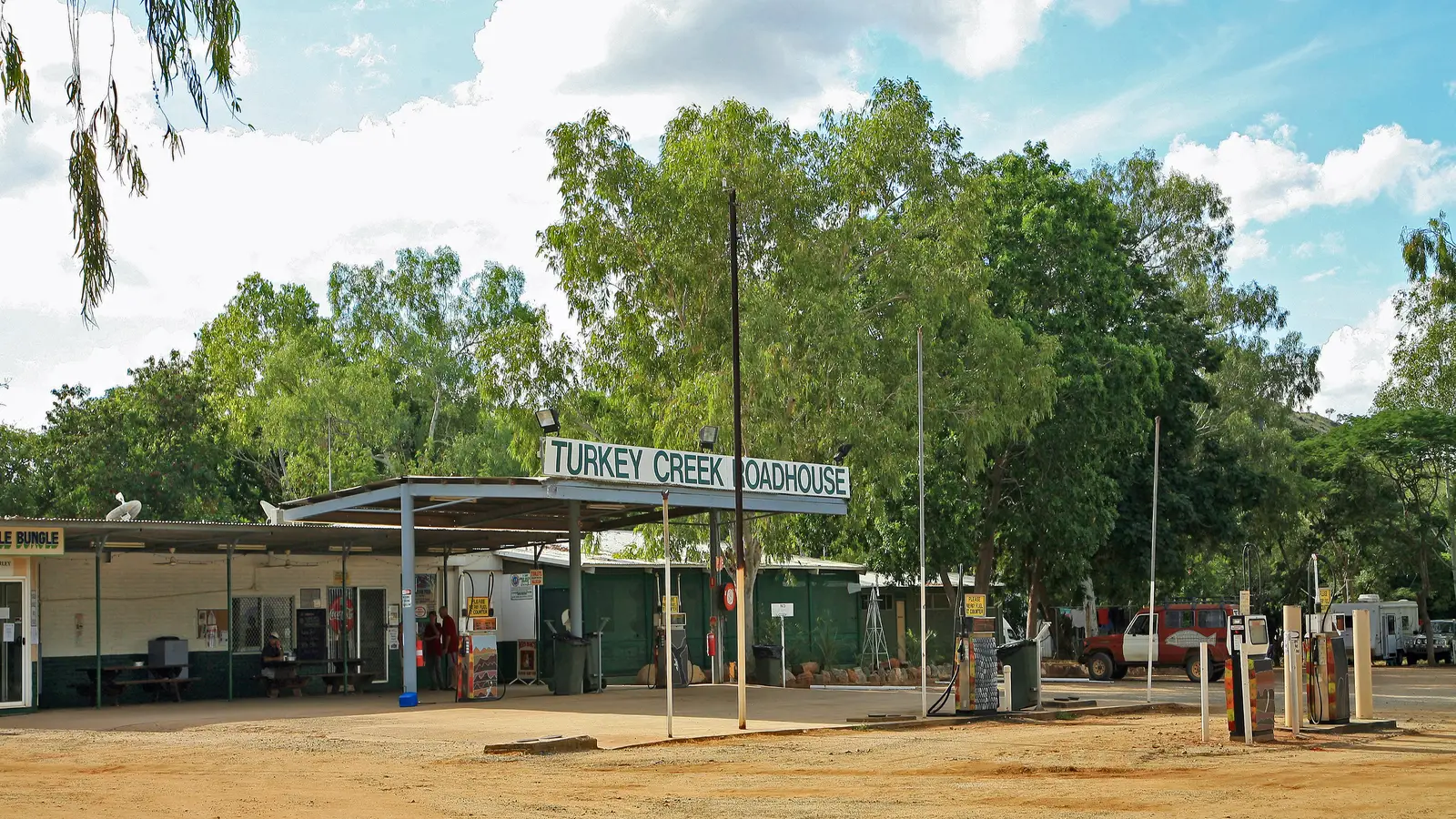
Roadhouse spacing is not uniform, and averages hide the problem. Across the Nullarbor the Eyre Highway runs about 1,206 kilometres between Norseman and Ceduna with no towns in between, only thirteen fuel stops, most of them roadhouses. Some of those stops sit a few minutes apart; others are close to 200 kilometres apart. Three legs are well over 150 kilometres, and they are the ones that decide your tank size.
In Western Australia, Main Roads notes that the distance between some remote towns can be considerable, and that roughly 40 roadhouses across the state provide a safe stopping place — privately owned, with fuel availability worth confirming before you rely on it. On the Stuart Highway the Northern Territory's own rest-stop list makes the same point in distances: the King rest area, 46 kilometres south of Katherine, lists Tennant Creek as its nearest town to the south, 624 kilometres away. If your route starts in the Centre rather than the west, rides out of Alice Springs has the local fuel geography.
| Leg on the Eyre Highway | Distance | Why it matters |
|---|---|---|
| Norseman to Balladonia | 191 km | First or last leg of the crossing, nothing in between |
| Border Village to Nullarbor Roadhouse | 186 km | Runs along the top of the Bunda Cliffs |
| Balladonia to Caiguna | 182 km | Includes the 90 Mile Straight |
Carrying fuel legally and safely
Spare fuel is a sensible answer to a long leg, but it is a dangerous good, not a picnic item. WorkSafe Western Australia sets out the rules clearly: petrol should be carried in UN-approved jerry cans complying with AS 2906, and the capacity of containers filled at service stations is limited to 25 litres. Petrol vapour venting inside a vehicle can form an explosive mixture, and ignition sources include something as ordinary as a remote locking fob or a cigarette.
The practical rules that follow are about restraint and ventilation. Containers should be upright, sealed, restrained so they cannot move, and carried where air flows past them — a trailer or a ute tray if you have one, otherwise with the vehicle ventilated. Keep them away from fertilisers and oxidising agents, and do not smoke or vape anywhere near them.
- UN-approved containers to AS 2906, filled to the marked capacity
- Upright and restrained, never loose in a pannier
- Ventilation through the vehicle, not a sealed compartment
- Refuel away from hot exhausts and never beside a campfire
- Check the container and cap for perishing before every trip
Water: the number to plan around
Water is the one supply where underestimating is unrecoverable. South Australia's arid lands guidance gives figures you can plan with: during mild weather, estimate six litres per person per day; during warmer weather, estimate ten litres per person per day; and carry a three to four day reserve on top of what you expect to drink. That reserve is not for the trip going well.
Two things make the arithmetic harder on a bike. You cannot carry as much as a vehicle can, and the wind hides how much you are losing: at speed you do not notice the sweat, and a helmet and jacket raise the effort of simply sitting in the sun. Carry water in more than one container so a single leak does not cost you the whole supply, and keep a bottle where you can drink from it without stopping to unpack.
- Six litres per person per day in mild weather, ten in warm weather, plus a three to four day reserve
- Split the supply across at least two containers
- Drink before you feel thirsty, and drink at every stop rather than in one long break
- Carry electrolyte tablets for days when sweat losses are high
- Never ration water to make it last — turn around instead
Heat, and knowing when to stop
Heat illness on a motorcycle builds quietly. The wind hides sweat, so you dehydrate without noticing, and a full-face helmet raises the effort of simply existing in the sun. The early signs — headache, clumsiness, irritability, a sudden loss of pace — are easy to blame on the road or the bike.
The sensible rule in the Centre and the north-west is to ride the cool hours and stop through the hottest part of the day, which is also when the light is worst and the wildlife least visible. If you are riding into a headwind on a hot afternoon to keep a schedule, the schedule is the problem.
The Northern Territory's rest stop guidance is to take a break every two hours on long-distance drives; on a bike in the heat, plan for shorter stints than that.
UHF, beacons and the plan you leave behind
Mobile coverage in the outback is the exception, not the rule. South Australia's arid lands guidance estimates that only about five per cent of the outback has mobile phone range, mostly in townships on the main sealed roads, with sporadic coverage on unsealed roads. Plan for a trip with no phone signal rather than hoping for one.
UHF radio is the working tool for the bush. Channel 40 is the road or truckies channel, channels 5 and 35 are for emergency use only, and the repeater channels broadcast over a longer distance — the arid lands guidance notes repeaters can reach up to 100 kilometres. Main Roads Western Australia also notes that oversize load pilots and traffic escort wardens can be contacted on channel 40. Above that sits the personal locator beacon: a registered digital beacon is the device that works when nothing else does.
- Tell a named person your route, the towns you expect to pass and your expected arrival dates
- Agree a check-in time and what they should do if you miss it
- Carry a personal locator beacon registered with AMSA
- Set the UHF to channel 40 for road trains and oversize movements
- Carry a paper map of the region, not only a phone
Wildlife and livestock at dawn and dusk
Animals are the most predictable hazard in the outback and the one riders most often meet at the worst time of day. Main Roads Western Australia reports that analysis on the Great Northern Highway found approximately 83 per cent of cattle-related crashes occur at dawn, dusk or night-time, and makes the point that you cannot hear animals on the road and usually cannot see them until it is too late.
The response is not complicated: slow down in the last hour of daylight and the first hour after sunrise, scan the shoulders rather than the centre line, and treat a warning sign as a statement about the next few kilometres rather than a decoration. If you see one animal, assume there are more — livestock move in mobs and a single beast on the verge usually has company behind it.
If you see one cow on the road or roadside, slow down and take note of your surroundings — the second and third animals are the ones that get riders.
Stopping for the night outside a town
Sleeping rough is legal in some places and firmly not in others, and the difference is signposted. The Northern Territory publishes a list of rest stops on the Stuart Highway and states which allow 24 hour overnight camping and which do not; Bridge Creek, King, Warloch and several others permit it, while Manton Dam and Coomalie Creek do not. Read the list before dark rather than arriving and guessing.
On South Australian pastoral country the rules are tighter again: along public access routes you must camp within 100 metres of the track, at least one kilometre from homesteads and other buildings, and not within 500 metres of stock watering points. Carry out everything you bring in, and do not light a fire without checking the current restrictions. If a night in a bed and a proper kitchen would reset the trip, campervan hire in Alice Springs is an alternative to another night in a swag, and it keeps the bike free for the day rides that made the trip worth doing.
Questions riders ask
How far apart are fuel stops on the Nullarbor?
Between Norseman and Ceduna the Eyre Highway runs about 1,206 kilometres with thirteen fuel stops and no towns. Three legs exceed 150 kilometres: Norseman to Balladonia at 191 km, Border Village to Nullarbor Roadhouse at 186 km, and Balladonia to Caiguna at 182 km.
How much water should I carry in the outback?
South Australia's arid lands guidance suggests six litres per person per day in mild weather and ten litres in warmer weather, plus a three to four day reserve supply.
Which UHF channel do road trains use?
Channel 40 is the road and truckies channel in Australia, and Main Roads Western Australia notes that oversize load pilots and traffic escort wardens can be contacted on it.
Can I camp at a Northern Territory rest stop?
Some allow 24 hour overnight camping and some explicitly do not. The NT Government publishes a rest stop list on the Stuart Highway that states which is which for each stop.
Sources
- Landscape South Australia (Arid Lands) — Outback safety — naturalresources.sa.gov.au
- Main Roads Western Australia — Driving in WA: a guide to safe stopping places(mainroads.wa.gov.au)
- NT Government — Road rest stops in NT(nt.gov.au)
- WorkSafe Western Australia — Transporting containers of petrol(worksafe.wa.gov.au)
- Nullarbor Net — Fuel stops and distances on the Eyre Highway(nullarbornet.com.au)